 ICES Metadata Catalogue
ICES Trawl Survey Datasets (DATRAS)
DATRAS is an online database of trawl surveys with access to standard data products.
DATRAS (the Database of Trawl Surveys) has been developed to collate and document the survey data, assure data quality, standardise data formats and calculations, and ease data handling and availability. With the possibility for instant remote access, the data from DATRAS are used for stock assessments and fish community studies by the ICES community and public users.
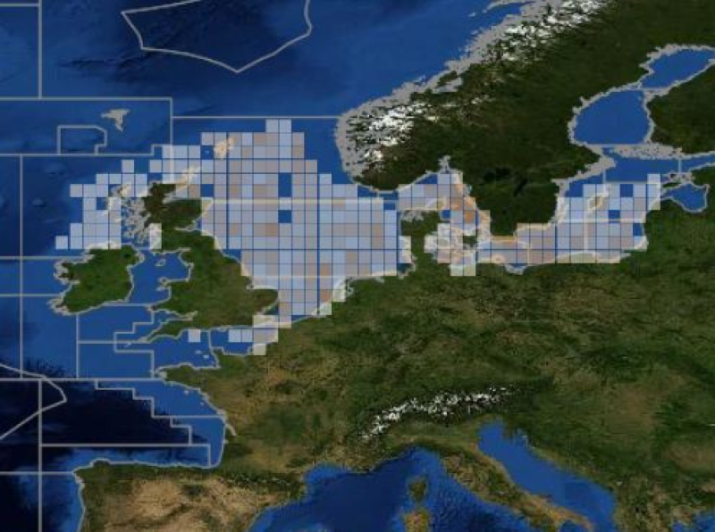
DATRAS stores data collected primarily from bottom trawl fish surveys coordinated by ICES expert groups. The survey data are covering the Baltic Sea, Skagerrak, Kattegat, North Sea, English Channel, Celtic Sea, Irish Sea, Bay of Biscay and the eastern Atlantic from the Shetlands to Gibraltar. At present, there are more than 45 years of continuous time series data in DATRAS, and survey data are continuously updated by national institutions.
Simple
- Date (Publication)
- 2011-01-01T11:10:00
- Edition
-
20180118
- Citation identifier
- https://gis.ices.dk/geonetwork/srv/metadata/68a3376b-c85c-4b4e-a6b8-8ebea73bb427
- Presentation form
- Digital profile
- Purpose
-
Trawl survey data products are used by the ICES community (expert groups, scientists) and public users. Data is used for fish stock assesments and marine biology studies.
- Status
- On going
- Point of contact
-
Organisation name Individual name Electronic mail address Role ICES
ICES Data manager
Originator
- Maintenance and update frequency
- Continual
- Theme
-
-
ICES
-
DATRAS
-
Trawl Survey Data
-
Trawl surveys
-
trawl survey database
-
- Place
-
-
North Sea
-
Baltic Sea
-
Northeast Atlantic
-
- Access constraints
- Other restrictions
- Other constraints
- no limitations to public access
- Use constraints
- Other restrictions
- Other constraints
-
Available under the Creative Commons Attribution (CC-BY) License v4.0
- Use limitation
-
Available under the Creative Commons Attribution (CC-BY) License v4.0
- Use limitation
-
Data is available under the terms of the ICES Data Policy. (See: https://ices.dk/data/guidelines-and-policy/Pages/ICES-data-policy.aspx)
- Spatial representation type
- Text, table
- Language
-
eng
- Character set
- UTF8
- Topic category
-
- Biota
- Begin date
- 1965-01-01T14:03:00
))
- Reference system identifier
- WGS 1984
- Distribution format
-
Name Version ZIP
1
Digital transfer options
- OnLine resource
-
Protocol Linkage Name WWW:LINK-1.0-http--link
https://ices.dk/data/data-portals/Pages/DATRAS.aspx DATRAS landing page
WWW:LINK-1.0-http--link
https://datras.ices.dk/Data_products/Download/Download_Data_public.aspx DATRAS data download page WWW:LINK-1.0-http--related
https://data.ices.dk ICES data portal
WWW:LINK-1.0-http--link
https://datras.ices.dk/WebServices/Webservices.aspx DATRAS Web services page
- Hierarchy level
- Dataset
Conformance result
- Title
-
commission regulation (eu) no 1089/2010 of 23 november 2010 implementing directive 2007/2/ec of the european parliament and of the council as regards interoperability of spatial data sets and services
- Date (Publication)
- 2010-11-23
- Pass
- Yes
- Statement
-
ICES is a receiver of Marine Data from national programmes and other marine institutes, therefore ICES is not the primary collection point of marine evidence that it holds and disseminates to the users of the data.
Data are quality assured using internal and external programmes. For example, the national laboratories that take part in monitoring programmes related to contaminants and biological effects that submit information to ICES, subscribe to the Quality Assurance of Information for Marine Environmental Monitoring in Europe (QUASIMEME) or the Biological Effects Quality Assurance in Monitoring Programmes (BEQUALM) inter-laboratory proficiency-testing schemes and perform internal quality assurance. ICES operates through a network of scientific expert and advisory groups. These groups, and the processes they feed into, act as a quality check on the marine evidence, both in terms of how the evidence was gathered and how the evidence has been subsequently treated. The groups, in cooperation with regional programmes under the Regional Sea Conventions, set standards and guidelines for the collection, transmission and analysis of these data.
In addition, the ICES Secretariat provides supplementary quality assurance through its internal programmes related to the different types of marine data collection datasets, which is fedback to the participating national and regional programmes. These internal and external programmes and procedures have been established over a period of 30 or more years. They continue to evolve and strive to reflect the best available practices in the collection and treatment of marine data relevant to the ICES community.
Metadata
- File identifier
- 68a3376b-c85c-4b4e-a6b8-8ebea73bb427 XML
- Metadata language
-
eng
- Character set
- UTF8
- Hierarchy level
- Dataset
- Date stamp
- 2026-05-07T10:42:19.0338949Z
- Metadata standard name
-
ISO 19115:2003/19139
- Metadata standard version
-
1.0
- Metadata author
-
Organisation name Individual name Electronic mail address Role ICES
ICES Data manager
Originator
)))